


Adden - IT
Adler - Mount Olive Township; IT train stop
Alton Siding - Carlinville Township; IT only a train stop; Illinois Place Names: ALTON SIDING (Macoupin). Now part of Carlinville.
Anderson - Carlinville Township; only a train stop; Illinois Place Names: ANDERSON (Macoupin). IT; RFD Carlinville.
Anderson - South Otter Township
Anderson Substation - Brushy Mound Township; only an IT train stop
Atwater - Shaws Point Township; Lat 391958N Long 0894330W; Illinois Place Names: ATWATER (Macoupin). PO est. 24 Feb 1881; active; RFD serves Schoper. CB&Q. Pop. (RM58) 100. Atwater is located in Section 11 of Shaws Point Township. Atwater was not established until after 1875 and the Jacksonville Southeastern Railroad line was built. The town is about three blocks by three blocks with quite a few town lots in size. There was a post office in Atwater. Atwater still exists as a small town. Before Atwater existed, post offices used by the area's people were Zanesville and Litchfield in the cross the border county of Montgomery. Zanesville post office was discontinued by 1881 and mail for that community went to Atwater.
Barnett - Shaws Point Township; Illinois Place Names: BARNETT named after Fred C. and Authur L. Barnett. Est. 7 Sep 1880, disb since 1931; now rfd Carlinville. CB & Q Railroad. [In Montgomery County?]
Barr - Barr Township; Illinois Place Names: BARR (Macoupin). PO est. (ch. from Barr's store) 30 Jan 1895; dis. 30 Sep 1905; now RFD Palmyra. Named for Benjamin R. Barr, storekeeper and PM.
Barr's Store - Barr Township; Lat 392417N Long 0900615W; Illinois Place Names: BARR'S STORE (Macoupin). PO est. 9 Aug 1950; ch. to Barr 30 Jan 1895. Barr's Store was located in Sections 8 and 9 of Barr Township. Barr's Store was named for Benjamin Barr and the post office was established 9 Aug 1850. It was changed to Barr. In 1875, the town of Barr's Store had a mill, the Post Office, a Methodist Church, IOOF Hall, a physician and surgeon, 18 assorted sized town lots, a main street named Broadway, another street, an alley. School #2 was about a mile and half northwest of the town.
Bayless - Gillespie & Dorchester Townships; Illinois Place Names:
BAYLESS (Macoupin). Now part of Dorchester (see state atlas, 1876). Bayless was
established before 1875. It is located in Section 33 of Gillespie Township.
The plat of Bayless is marked on a current plat map. Bayless was formerly
Baylestown and before that it was known as Boylestown.
Baylestown - Dorchester Township; Illinois Place Names: BAYLESTOWN (Macoupin). RFD Dorchester (RM58).
Bear Creek Point - Illinois Place Names: BEAR CREEK POINT (Macoupin). See 1879 hist. 43.
Bear Rough Point - Western Mound Township; Not a populated place; An article from Jim Frank, in the Macoupin County Enquirer, issue dated March 22, 1893, titled Macoupin's Early Days: "This writer remembers distinctly hearing the old pioneers relate their dangerous encounters with the bear. Some three miles north-east of Chesterfield there is a point of timber running out south of Bear creek, some three miles into the prairie. In the early days this was named "Bear-Rough Point" which name it retains to this day. It was so named on account of the great number of bears which inhabited the area. We remember having heard Joseph Hodges (who was a son of Seth Hodges) relate the facts and circumstances attending the slaughter of many of these animals by his father and others in "Bear Rough Point", and it is absolutely certain that this point as well as Bear creek took their names from the fact of there being found in their precincts such vast numbers of this animal."
Beaver Dam State Park - Polk Township; Section 22
Behme - Brushy Mound Township; only an IT train stop
Benld - Cahokia Township; Lat 390534N Long 0894814W; Illinois Place Names: BENLD (Macoupin). Named for Ben L. Dorsey. PO est 21 Mar 1904; active. Inc-c-7/30/1904. C&NW/IT/L&M. Pop. (1960) 1848.; Mt. Olive Herald, 1903, contributed by S. Viehweg: "The St. Louis paper contained items that contracts for 800 houses that had already been let and that a new town between Mt. Olive and Gillespie will soon have a population of 5,000. Of course these figures are rather large and it will be quite awhile before it will come up to the expectation of the founders. The new town has been named 'Benld.' It is a peculiar name and is thus explained. Benjamin L. Dorsey was a leading light in getting the coal rights and the land for the town. When the naming of the town was at hand, he drew "Ben" from his Christian name, "L" from his following name and the "D" stands for the Dorseys, who have done so much for the farmers and farm owners in that section."
Bethel - Carlinville Township; was a community about 10 miles east of Carlinville.
Bierd - Carlinville Township; only a train stop; Illinois Place Names: BIERD (Macoupin). Listed in RM56 but not 58; GM&O. RFD Carlinville.
Borough Station - Brushy Mound Township; settlement; Illinois Place Names: BOROUGH STATION (Macoupin). See 1911 hist. 372.
Bowman - Girard Township; Illinois Place Names: BOWMAN (Macoupin). IT.
Boylestown - Dorchester or Gilles Township; Illinois Place Names: BOYLESTOWN (Macoupin). Listed in RM56 but not 58, RFD Dorchester. pop. 25.
Brighton - Brighton Township; Brighton is located in Sections 18 and 19 of Brighton Township; Illinois Place Names: BRIGHTON (Macoupin/Jersey). PO est. (in Macoupin Co.) 11 Mar 1837; active; RFD serves Miles. Inc-v-2/23/1859. CB&Q/GM&O. Includes Bristol. Pop. (1960) 1248. was established 11 Mar 1837.; Brighton's population in 1980 was 2,364 and in 1990 the population was 2,270; Victor Hicken who was raised in Gillespie writes, "Meredith Wilson of "The Music Man" fame used to spend his summers with his grandmother in Brighton, Illinois. In fact, in the movie, the first scene opens at a train station named Brighton."
Bristol - Brighton Township; Illinois Place Names: BRISTOL (Macoupin). Now part of Brighton (1911 hist. 412).
Brooklyn - Hilyard Township; Illinois Place Names: BROOKLYN (Macoupin). see 1911 hist. 404.
Brushy Mound Prairie - Brushy Mound Township; settlement; Illinois Place Names: BRUSHY MOUND PRAIRIE (Macoupin). See 1911 hist. 372.
Buford - South Otter Township; Illinois Place Names: BUFORD (Macoupin). PO est. (ch. from Elroy) 26 Feb 1862; dis. 22 Dec 1887. Formerly Elroy, Hoover's Point, Standard.
Bunker Hill - Bunker Hill Township; Lat 390234N Long 0895706W; Illinois Place Names: BUNKER HILL (Macoupin). PO est. (changed from Lincoln) 23 Jun 1842; active; RFD serves Millville and Woodburn. Inc-c-/2/17/1857. NYC. Formerly Lincoln, Wolf Ridge. Pop. (1960) 1524.
Burgdorf - IT
C&NW Crossing - IT
Carlin - Carlinville Township; only a train stop; north of Carlinville.
Carlinville - Carlinville Township; Illinois Place Names: CARLINVILLE (Macoupin). PO est. 26 Feb 1830; active; RFD serves Anderson, Bierd, Clark, Comer (Bird Township), Davis, Enos (Bird Township), Hammann, Loveless, Moody, Rinaker, Sheeps, White City and Womac. Inc-3-/4/1837. GM&O/IT. Includes Alton Siding. Pop. (1960) 5,410.
Carlsburg - Mount Olive Township; Lat 390500N Long 0894320W; Edna Grosenheider wrote, "I don't know the history of Carlsburg, but there are still people living there, and it touches Mt. Olive on the north. I don't know that it is indicated on any map."
Cavendar - Gillespie Township; Illinois Place Names: CAVENDAR (Macoupin). Listed in RM 56 but not 58; RFD Gillespie. IT.
Centerville - Hilyard Township; Lat 390603N Long 0895841W; Centerville was not established until after 1893-94 although on the 1875 plat map a church, cemetery, and school were at the same location. Centerville is marked on a recent plat map at the intersections of Sections 27, 28, 33, and 34 in Hilyard Township.; not mentioned in Illinois Place Names.
Challacombe - Chesterfield Township; Lat 391306N Long 0900716W; Challacombe was located in Section 20 of Chesterfield Township. Challacombe was established after 1875 with the building of the St Louis, Chicago, and St Paul Railroad Line. The area is marked on a recent plat map.; Illinois Place Names: CHALLACOMBE (Macoupin). PO est. 3 Jun 1887, disb 19 Jan 1909, now RFD Medora.
Chapman's Point - North Otter Township; Illinois Place Names: CHAPMAN'S POINT (Macoupin). Same as Stirrup Grove.
Chesterfield - Chesterfield Township; Lat 391518N Long 0900347W; In 1875, Chesterfield had a Masonic and IOOF Hall, the Congregational Church, the Methodist Church, a Mill, the Episcopal Church, and Greenwood Academy.; By the time of the 1893-94 plat map, the St Louis, Chicago, and St Paul Railroad ran through Chesterfield. Two grain elevators were built near the railroad tracks, a hotel was in the town, a creamery was located near the tracks, a store was in the town, and the Greenwood Academy does not show on the 1893-94 plat map.; Illinois Place Names: CHESTERFIELD (Maccoupin). PO Est. 9 May 1838; active; RFD serves Hagaman and Reader/Reeders. Inc-v-8/22//1881. Pop. (1960) 280.
Chicago, Burlington & Quincy Junction - Listed in RM56 but not 58; RFD Mt Olive. L&M
Clark - Carlinville Township; only a train stop; Illinois Place Names: CLARK (Macoupin). RFD Carlinville. IT.
Clyde - Cahokia Township; Illinois Place Names: CLYDE (Macoupin). Now Hornsby.; From Shirley Denson: "Clyde was later renamed Hornsby when another location in IL had a Clyde Post Office before the named Clyde in Macoupin County. Clyde Post Office was used on the 1860 Federal Census. As early as 1875, the post office at Clyde was named Hornsby Post Office, yet, the town was called Clyde. Sometime after 1893-94, the town's name became Hornsby."
Coin - Galbraith map
Coline - IT
Comer - Bird Township; Lat 391735N Long 0895814W; Illinois Place Names: COMER (Macoupin). Listed in RM56 but not 58; PO est. 2 Apr 1887; dis. 29 Feb 1904; RFD Carlinville, Pop. 6. Named for Samuel Comer, PM.; Comer was established when the Jacksonville Southeastern RR Line was built. Comer was located near the railroad. Comer was located northwest of Carlinville in Section 22 of Bird Township. Comer is marked on a recent plat book.
Coopers - South Otter Township; RFD. Girard. IT train stop.
Coop's Mound - Shaw's Point Township; an area mentioned several times in 1879 History of Macoupin County, for example, page 24 "... in 1825 or '26 removed to the mound, thereafter to be known as Coop's Mound, which lies nearly six miles northeast of the capital of the county." and page 32 "... Coop's Mound, eight miles northeast of Carlinville. This mound covers an area of several acres, and is about sixty feet in height above the level of the adjacent prairie. It was originally covered with a heavy growth of oak and hickory, and from its summit a beautiful view of the surrounding country may be seen."
Corn - PO est. Jul 9, 1895; dis. Aug 27, 1897; Possibly misread and should be Coin.
Corneilson Mound - Bunker Hill Township; Illinois Place Names: CORNEILSON MOUND Macoupin. Also Tickey Mound. See 1879 hist. 143.
Cummington - North Palmyra Township; Illinois Place Names: CUMMINGTON (Macoupin). PO est. (ch. from Eagle Point) 2 Nov 1841; ch. to Palmyra 25 May 1858.
Davis - Brushy Mound Township; Illinois Place Names: DAVIS SIDING (Macoupin). Listed in RM56 but not 58; RFD Carlinville. IT.
Delaware - Chesterfield Township; Illinois Place Names: DELAWARE (Jersey). PO est. 1 Apr 1837; ch. to Rhoades' Point 30 Jun 1851; now Medora (Macoupin Co.) (in Greene Co. prior to creation of Jersey Co. 28 Feb 1839).
Delay - Bird Township; Lat391804N Long 0900027W; Illinois Place Names: DELAY (Macoupin). PO established 04/09/1888, changed to Enos 04/10/1895.; Delay was located in Section 20 of Bird Township northwest of Carlinville near the Jacksonville Southeastern Railroad Line. Delay had a store and quite a few town lots.
DePiasas - Shipman Township; Lat 390657N Long 0900725W; Illinois Place Names: DE PIASAS (Macoupin). Now Piasa.
Dickerson - IT
Dingerson - Mount Olive Township; IT train stop
Dorchester - Gillespie & Cahokia & Dorchester Townships; Lat 390508N Long 0895315W; Illinois Place Names: DORCHESTER (Macoupin). PO est. 1 Aug 1860; actve; RFD serves Baylestown/Boylestown. Inc0v-3/2/1875. NYC. Includes Bayless. Pop. (1960) 161.
Douglas - Cahokia Township; Illinois Place Names: DOUGLASS (Macoupin). PO est. 30 Dec 1835; ch to Hendersons Cross Roads 23 Jan 1839; now Henderson.
Drummond Station - Mount Olive Township; Lat 390420N Long 0894338W; Illinois Place Names: DRUMMOND STATION (Macoupin). Now Mt. Olive (1879 hist. 126).
Dry Point - PO est. Mar 17, 1838; dis. Jul 6, 1838
Duncan - Gillespie Township; Illinois Place Names: DUNCAN (Macoupin). Listed in RM 56 but not 58; RFD Gillespie. NYC.
Eagerville - Cahokia Township; Lat 390642N Long 0894702W; Illinois Place Names: EAGERVILLE (Macoupin). PO est. since 1931; active. Inc-v-10/28/1915. Pop. (1960) 149.
Eagle Point - North Palmyra Township; Illinois Place Names: EAGLE POINT (Macoupin). PO est. 26 Mar 1833; ch. to Cummington 2 Nov 1841; now Palmyra.
East Gillespie - Gillespie & Cahokia Townships; Lat 390827N Long 0894844W; EAST GILLESPIE (Macoupin). RFD Gillespie. Inc-v-3/23/1938. Pop. (1960) 208. East Gillespie is located in both Gillespie and Cahokia Townships. In 1970, the population was 187, in 1980, 197 and, in 1990, 205.
East Mount Olive - Mount Olive Township; Illinois Place Names: EAST MT OLIVE (Macoupin). Now part of Mt. Olive.
Elm Grove - North Otter Township; There was no post office at Elm Grove. Elm Grove was located at the north edge of Section 3 in North Otter.; Illinois Place Names: ELM GROVE (Macoupin). See 1879 hist. 258.; 1879 Macoupin History book, page 258: "When near Elm Grove, in this township, and on what is known as "Gopher Hill," they stopped to rest, and Aaron came up behind him....."
Elroy - South Otter Township; Illinois Place Names: ELROY (Macoupin). PO est. (ch. from Hoover's Point) 18 Jun 1861; ch. to Buford 26 Feb 1862.
Emrick/Emerick - Brushy Mound Township; only an IT train stop
Enos - Bird Township; Lat391804N Long 0900027W; Illinois Place Names: ENOS (Macoupin) PO est. (ch. from Delay) 4/10/1895; dis. 6/15/1913; now RFD Carlinville. Also an IT stop from IT data.; Enos was located in Section 20 of Bird Township northwest of Carlinville near the Jacksonville Southeastern Railroad Line. Enos had a store and quite a few town lots. The location of Enos is marked on a recent plat map.
Fayette - Western Mound Township; Fayette was located in Greene County but the Post Office at Fayette was used by residents on the western side of Western Mound Township.
Frog Town - Staunton Township; not really a town; Contributed by Laura Johnson: "The reason that [the area] is called Frog Town is that the land is lower in this area of town. During the rainy spring time, the frogs are very abundant in the area. Frog Town is south of Tenth street and west of Maple in Staunton on the south side of the tracks and south of Washington Street on the north side of the tracks. I live in Frog Town which is a part of Staunton on the north side of the tracks. But Frog Town on the South side of the tracks can be in both Macoupin and Madison County. Union Street in Staunton picks back up on the south side of the tracks and once it crosses the county line, there are probably about 25 houses out that way that are considered Frog Town as well."
Fulton - North Otter & Girard Townships; Fulton was never an incorporated village. The plat was laid out but never became a village when the railroad decided to run farther east.; Illinois Place Names: FULTON (Macoupin). See Girard Gazette 16 Jun 1955.; Excerpted from the article, "Girard Might Have Been Named Fulton," by Ethel Weddle, June 1955, Centennial Edition of the Girard Gazette: "One of the early surveys caused the beginning of a village named Fulton. Fulton was located on 3 acres in the southwest quarter of section 22 in North Otter Township. A general store, a blacksmith shop, and a few dwellings were built in Fulton. When the Chicago and Alton Railroad Company built their railroad farther west in Girard Township, the small village died in its infancy."; Contributed by Carolynn Jones Bettis: "Mrs. Sanders, the owner of the land where Fulton was situated said that the buildings in Fulton were torn down and used in their farm buildings. In 1955, part of those farm buildings on the Sanders land was over a 100 years old. In 1997, a Sanders family still owns the house and 3 acres where Fulton once stood, and a member of the Sanders family occupies the house."
Garrell - IT
Gillespie - Gillespie & Cahokia Townships; Lat 390747N Long 0894910W; Illinois Place Names: GILLESPIE (Macoupin) PO est. (ch. from Prairie Farm) 13 Feb 1854; active; RFD serves Cavendar, Duncan, East Gillespie and Henderson. Inc-c-3/301869. IT/NYC. Pop. (1960) 3,569. Gillespie is located nine miles west of Interstate 55 at Exit 52.
Girard - Girard Township; Lat 392647N Long 0894651W; Illinois Place Names: GIRARD (Macoupin). PO est. (ch. from Pleasant Grove) 20 Jan 1855; active; RFD serves Coopers, Green Ridge and McVey. Inc-c-2/14/1855. C&NW / CB&Q / GM&O / IT. Formerly Otter Creek, Pleasant Grove, Waytown, Pop. (1960) 1734. Girard's population in 1980 was 2,246 and, in 1990, the population was 2,164.
Gopher Hill - North Otter Township; 1879 Macoupin History book, p 258: "When near Elm Grove, in this township, and on what is known as "Gopher Hill," they stopped to rest, and Aaron came up behind him....."
Greasy - South Otter Township; Illinois Place Names: GREASY (Macoupin). PO est. 28 Aug 1862; dis. 9 Feb 1871.; Contributed by Carolynn Jones Bettis: "I believe the Greasy Post Office may have been located in the southwest quarter of Section 8 in South Otter Township near the Pleasant Dale Church (in 1997), and the mail route for Greasy Post Office extended from this location into the southwest quarter of Section 36 in North Palmyra Township." Most people who lived in Greasy wouldn't admit it. They would always say, "It's just a little bit west of here." Anyone who might admit to being born in Greasy laughed when they would tell that they were born in Greasy. It is said that there are a few stories about how Greasy got its name. One story is that someone stole a whole ham and took it home. They hid it by burying it at the top of a hill. The sun came out and caused grease to ooze from the place the ham was buried giving away the identity of the thief, thus the name Greasy.
Green Ridge - Nilwood Township; Lat 392510N Long 0894740W; Illinois Place Names: GREEN RIDGE (Macoupin). RFD Girard. Formerly Greenridge.
Greenridge - Nilwood Township; Lat 392510N Long 0894740W; Illinois Place Names: GREENRIDGE (Macoupin). PO est. 24 Aug 1896; dis. 23 Jun 1898; reest. 4 Mar 1899; dis 31 Jan 1919; now Green Ridge.
Grinnerville - Nilwood Township; Grinnerville was located east of Nilwood.
Hagaman - Western Mound Township; Lat 391837N Long 0900441W; Hagaman was located north of Chesterfield in Section 15 of Western Mound Township. The town was established as the result of the building of the Jacksonville Southeastern Railroad Line. There was a hotel in the town and quite a few town lots.; Illinois Place Names: HAGAMAN (Macoupin). PO est. 18 July 1882; dis. since 1931; now RFD Chesterfield. Pop. (RM58) 30.
Hammann - Brushy Mound Township; only an IT train stop; RFD Carlinville
Hammer's Point - Cahokia Township; Illinois Place Names: HAMMERS POINT (Macoupin). Now Hornsby.
Harris Point - Nilwood Township; Illinois Place Names: HARRIS POINT (Macoupin). See 1879 hist. 207; Girard Gazette - Mar 25, 1880 pg. 4: "Harris Point is located five miles S. E. of Girard just across the lane south of T. McBride's dwelling. Harris Point is a point of timber, which is at present being divested of its largest trees to increase Mr. Mc's stock of rails."
Hartford - North Palmyra Township; In 1875, Hartford may have been in the area of School #5 east of Vancils Point in North Palmyra Township. Hartford doesn't show on the 1875 or the 1893-94 plat map.; not mentioned in Illinois Place Names
Henderson - Cahokia Township; Lat 390921N Long 0894743W; Illinois Place Names: HENDERSON (Macoupin). Listed in RM 56 but not 58; RFD Gillespie. Pop. 40. Formerly Douglass, Hendersons Crossroads.
Hendersons Cross Roads - Cahokia Township; Illinois Place Names: HENDERSON CROSS ROADS (Macoupin). PO est. (ch. from Douglas) 23 Jan 1839. dis. 10 Dec 1841. Now Henderson. Douglas 30 Dec 1835 changed to Henderson's Cross Roads 23 Jan 1839.
Hettick - Barr & South Palmyra Townships; Lat 392118N Long 0900213W; Illinois Place Names: HETTICK (Macoupin) PO est. 18 Apr 1882; active. Inc-v-5/10/1892. Pop. (1960) 253.
Hickory Grove - Cemetery in Bird Township; School Number 102 in multiple townships; a farm in Nilwood Township; a Baptist church
Holliday Mills - Polk Township; Illinois Place Names: HOLLIDAY MILLS (Macoupin). Now Macoupin.
Honey Point - Cahokia & Mount Olive Townships; Lat 390420N Long 0894338W; Illinois Place Names: HONEY POINT (Macoupin). PO est. 30 Jul 1833; dis. 22 Jun 1835; reest. 5 Sep 1848; changed to Mt. Olive 27 1852; reest. (Mt Olive continuing) 6 Oct 1853; ch. to Hornsby 24 Dec 1855; reestablished (Hornsby PO continuing, but Mt. Olive PO having been discontinued) 8 Jul 1862; disbanded 13 Mar 1865.
Hoover's Point - South Otter Township; Illinois Place Names: HOOVER'S POINT (Macoupin). PO est. 30 May 1849; dis. ch. to Elroy 18 Jun 1861; later Buford.
Hornsby - Cahokia Township; Lat 391014N Long 0894442W; Illinois Place Names: HORNSBY (Macoupin). PO est. (ch. from Honey Point) 24 Dec 1855; dis. since 1931; now RFD Litchfield. NYC. Formerly Clyde, Hammer's Point, Honey Point, Pop. (RM58) 60.
Karnes - Mount Olive Township; Illinois Place Names: KARNES (Macoupin). RFD Mt. Olive. L&M / Wab.
Leach - IT 1930 Stringham
Lincoln - Bunker Hill Township; Illinois Place Names: LINCOLN (Macoupin). PO est. 22 Jun 1833; ch. to Bunker Hill 23 Jun 1842.
Locust Spring - Place Names PO est. 8/26/1842; dis 11/10/1854
Loveless - Brushy Mound Township; only an IT train stop; RFD Carlinville
Loveless Park - Carlinville Township; Loveless Park, in Carlinville, is a relatively new multi-sport facility. This large sports complex offers visitors a playground, pavilion and picnic area, outdoor basketball and ice skating, Boys' Baseball Tournament, Boys' and Girls' Soccer Tournaments, Boys' and Girls' Soccer Leagues, Sand Volleyball Tournament, and Youth Baseball and Softball Leagues.
Macoupin - Polk Township; Illinois Place Names: MACOUPIN (Macoupin). PO est. (ch. from Macoupin Station) 14 May 1883; dis. since 1931; now RFD Plainview. GM&O. Formerly Holliday Mills, Macoupin Station.
Macoupin Station - Polk Township; Lat 391248N Long 0895726W; Illinois Place Names: MACOUPIN STATION (Macoupin). PO est 11 Apr 1866; disb 19 Aug 1869; reest 20 Dec 1869; changed to Macoupin 14 May 1883. Macoupin Station located in Section 23 of Polk Township was established before 1875. There was a Post Office, School, store and cemetery. In 1875, the Chicago, Alton, and St Louis Railroad ran by Macoupin Station. Macoupin Station was bustling when Beaver Dam and Clubhouse was built nearby. There was a hotel nearby then. In 2015, the Macoupin Station building is still standing and being taken care of. It is located on the Shipman road between Carlinville and Shipman about a 1/4 mile north of the Beaver Dam State Park entrance.
McVey - Nilwood Township; Lat 392323N Long 0894447W; McVey was established after 1875 when the Jacksonville Southeastern Railroad was built in the area. McVey was located in Section 22 of Nilwood Township. McVey was named after the MCVEY Family who settled in Macoupin County in 1825 and owned the land where the town of McVey was established. McVey had about 60 town lots, an elevator, and a depot.; Illinois Place Names: MCVEY (Macoupin). PO est. 21 Feb 1881; dis. 30 Dec 1916; now RFD Girard. Pop. (RM58) 25.; Girard Gazette Apr. 21, 1881, pg. 1: "McVey is a small town situated four miles southeast of Girard, 5 miles E. of Nilwood, 1 1/2 miles of Grinnerville."
Medora - Chesterfield & Shipman Township; Illinois Place Names: MEDORA (Macoupin). PO est. (ch. from Trumbull) 9 Jul 1866; active; RFD serves Challacombe. Inc-v-1/10/1874. CB&Q. Formerly Delaware, Rhoades' Point, Trumbull. Pop. (1960) 447.
Mell - Place Names IT 1930 Stringham
Meyer - Place Names IT 1930 Stringham
Miles - Brighton Township; Lat 390410N Long 0900626W; Illinois Place Names: MILE (Macoupin). Listed in RM 56 but not 58; RFD Brighton. GM&O. Pop. 23. Formerly Miles' Station.; Miles was listed in Rand McNally in 1956.
Miles' Station - Brighton Township; Lat 390410N Long 0900626W; Illinois Place Names: MILE'S STATION (Macoupin). PO est. 31 Aug 1856; dis. 31 Aug 1914. Now Miles, PM.; Miles Station was located in Sections 4 and 9 of Brighton Township. The location of Miles Station is marked on a current plat map. Miles Station was named after Jonathan R Miles, Postmaster.
Millville - Bunker Hill Township; Illinois Place Names: MILLVILLE (Macoupin). Listed in RM56 but not 58; RFD Bunker Hill. Pop. 15.
Mine No. 1 - Staunton Township; Illinois Place Names: MINE NO 1 (Macoupin). Now part of Staunton.
Mine No. 7 - Staunton Township; Illinois Place Names: MINE NO 7 (Macoupin). IT 1930 (Stringham)
Modesto - North Palmyra Township; Lat 392842N Long 0895855W; Illinois Place Names: MODESTO (Macoupin). PO est. 6 Mar 1882; active. Inc-v-3/16/1896. Pop. (1960) 228.
Monroe - Virden Township; Illinois Place Names: MONROE (Macoupin). RFD Virden. IT. (a stop on IT located about a 1/2 mile south of Virden)
Moody - Carlinville Township; only a train stop; RFD Carlinville; Illinois Place Names: MOODY (Macoupin). RFD Carlinville. IT.
Mount Clare - Gillespie Township; Lat 390555N Long 0894934W; Illinois Place Names: MOUNT CLARE (Macoupin). PO est. 26 Feb 1929, active. Inc-v-4/16/1915. Pop. (1960) 320.
Mount Olive - Cahokia & Mount Olive Townships; Lat 390420N Long 0894338W; Mt Olive is located on Route 138 east of Interstate 55; Illinois Place Names: MOUNT OLIVE (Macoupin). (a) PO est. (ch. from Honey Point) 27 Jan 1852; dis 8 Aug 1855; (reest. as Honey Point). (b) PO est. (ch. from Rising Sun) 23 Aug 1867; active; RFD serves Chicago, Burlington & Quincy Junction and Karnes. Inc-v-10/?/1874 (1879 hist. 126; c-2/19/1917, IC/L&M/Wab. Includes Drummond Station, East Mt. Olive, Niemann's Settlement. Pop. (1960) 2,295.; Mt Olive's population was 2,357 in 1980 and, in 1990, the population was 2,126.
Mounts - Carlinville Township; IT only a train stop; Place Names IT 1930 Stringham
Negro Lick - Place Names see 1911 hist. 398
New Hartford - Place Names see TISHS XVII 195
Newburgh - North Palmyra Township; Lat 392842N Long 0895855W; Illinois Place Names: NEWBURGH (Macoupin). Now Palmyra.
Niemann's Settlement - Mount Olive Township; Illinois Place Names: NIEMANN'S SETTLEMENT (Macoupin). Now Mt. Olive (1879 hist. 126).
Nilwood - South Otter & Nilwood Townships; Lat 392353N Long 0894831W; Illinois Place Names: NILWOOD (Macoupin). PO est. 3 Oct 1856; active. Inc-t-3/9/1867. GM&O/IT. Pop. (1960) 274.
North Bend - Polk Township; Illinois Place Names: NORTH BEND (Macoupin) Also Steubenville (1879 hist. 213); Mentioned in Jim Frank's History of Polk Township: "Peter Wagoner built the first house on the prairie, and from this settlement originated the name "Wagoner's Prairie," which the prairie surrounding the Plainview locality came to be called. This area south of the Macoupin creek in early days was also known as North Bend because of the fact the prairie bent to the north in this area."
Nursery - Place Names IT 1930 Stringham
Otter Creek - Girard Township; Illinois Place Names: OTTER CREEK (Macoupin). Now Girard. Cf. Otterville.
Otterville - Girard Township; Illinois Place Names: OTTER CREEK (Macoupin). Now Girard. Cf. Otterville.
Palmyra - North Palmyra & South Palmyra Townships; Lat 392842N Long 0895855W; Illinois Place Names: PALMYRA (Macoupin). PO est. (ch. from Cummington) 25 May 1858; active; RFD serves Barr. Inc-v-7/15/1881. Formerly Cummington, Eagle Point, Newburgh. Pop. (1960) 811. In 1980, Palmyra's population was 864. In 1990, the population was 722.
Piasa - Shipman Township; Lat 390657N Long 0900725W; Illinois Place Names: PIASA (Macoupin). PO est. 19 Nov 1849; active. CB&Q. Formerly De Piasas. Pop. (RM58) 100. Piasa is mostly located in Section 20 of Shipman Township. Piasa was established on a creek before 1875. Piasa Post Office was used on the 1860 Federal Census. By 1875, the Rockford, Rock Island, and St Louis Railroad ran by Piasa. Piasa still exists as a small town on Route 16.
Plainview - Hilyard Township; Lat 390933N Long 0895923W; Plainview is located in Sections 4 and 9 of Hilyard Township. In 1875, the population of Plainview was nearly 400. In 1875, the Chicago, Alton, and St Louis Railroad ran through Plainview.; Illinois Place Names: PLAINVIEW (Macoupin). PO est 8 Jun 1846; active; RFD serves Macoupin. GM&O. Pop. (RM58) 150.
Plainview Station - Hilyard Township; Plainview Station was established and before 1853 it was moved to the tracted Plainview.; not mentioned in Illinois Place Names
Pleasant Grove - North Otter Township pr Girard Township; Illinois Place Names: PLEASANT GROVE (Macoupin). PO est 20 Jul 1848 and dis. Sep 1849; reest 1 Mar 1850; ch. to Girard 20 Jan 1855.
Prairie Farm - Gillespie Township; Illinois Place Names: PRAIRIE FARM (Macoupin). PO est. 31 Mar 1852; ch to Gillespie 13 Feb 1854.
Reader - Western Mound Township; Lat 391820N Long 0900227W; Illinois Place Names: READER (Macoupin). Listed in RM56 but not 58; PO est. 3 Apr 1888; dis. 15 Oct 1924; RFD Chesterfield. Pop. 20. Named for George W. Reader, PM. Cf. Reeders.; Reader was established close to the Jacksonville Southeastern Railroad Line in Section 13 of Western Mound Township. The town had quite a few town lots.; Reader was located north of Chesterfield and was named after George W Reader.
Reeders; Illinois Place Names: REEDERS (Macoupin). Listed in RM56 but not 58; RFD Chesterfield. Cf. Reader.
Rhoades' Point - Chesterfield Township; Illinois Place Names: RHOADES' POINT (Macoupin). PO est. (ch from Delaware 30 Jun 1851; ch. to Trumbull 16 Feb 1863; now Medora.
Rinaker - Carlinville Township; only a train stop; Illinois Place Names: RINAKER (Macoupin). Listed in RM56 but not 58; RFD Carlinville. GM&O.
Rising Sun - Mount Olive Township; Illinois Place Names: RISING SUN (Macoupin). PO est. (in Montgomery Co.) 26 Sep 1851; ch. to Macoupin Co. ca. 11 Feb 1854; ch. to Mt. Olive 23 Aug 1867.
Royal Lakes - Hilyard Township; Lat 390637N Long 0895741W; In 1956, a Chicago Company bought two farms, created the Royal Lakes Resort Properties and plotted and laid out the farms into lots in sections 26 and 27 of Hilyard Township. Three small lakes were constructed and named Shadrach, Meshach, and Shad. Originally, older people from St. Louis had bought lots. In 1973, the village was incorporated and took the name of Royal Lakes. The population is less than 200.
Rural Park - Nilwood Township; not a populated place, located at Sulphur Springs; commonly called Wild Rural Park
Ruth - Nilwood Township; IT stop
Ruther - Staunton Township; Illinois Place Names: RUTHER (Macoupin). IT 1930 (Stringham)
Rutherford - Nilwood Township; IT stop
Sawyerville - Mount Olive Township; Illinois Place Names: SAWYERVILLE (Macoupin). PO est 17 Sep 1906; dis. 15 Jan 1910; reest. 6 Sep 1910; dis. 15 Dec 1914; reest. 21 Jun 1916; active. Inc-v-6/12/1907. IT. Pop. (1960) 362.
Schmutzler - Mount Olive Township; see Smutzler
Schoper - Shaws Point Township; Lat 392017N Long 0894703W; Illinois Place Names: SCHOPER (Macoupin). PO est. 5 Mar 1920, dis. 28 Feb 1922. now RFD Atwater. C&NW.
Scottville - Scottville Township; Lat 392849N Long 0900617W; Illinois Place Names: SCOTTVILLE (Macoupin). PO est 23 May 1850; active. Inc-v-1/31//1840. Pop. (1960) 186.; Village of Scottville's population in 1870 was 1,166, 1980 was 214 and in 1990 the population was 165.
Seymour Station - Nilwood Township; Girard Gazette, April 14, 1881, pg. 1: "Sulphur Springs is a small village, so called from two springs of sulphur water near by, and is situated one quarter miles west of Rural Park, and one mile east where Seymour Station ought to be."
Shaw's Point - Shaw's Point Township; Illinois Place Names: SHAW'S POINT (Macoupin). PO est. 7 May 1852; dis. 20 Nov 1865; reest. 15 Mar 1866; dis 19 Nov 1868; reest. 13 Jan 1869; dis. 28 Apr 1871.
Sheeps - Carlinville Township; only a train stop; Illinois Place Names: SHEEPS (Macoupin). RFD Carlinville. IT.
Shipman - Shipman Township; Lat 390703N Long 0900239W; Illinois Place Names: SHIPMAN (Macoupin). PO est. 2 Feb 1853; active. Inc-t-3/6/1867. GM&O. Pop (1960) 417. Shipman was established before 1875 in Section 24 of Shipman Township. Shipman Post Office was used on the 1860 Federal Census. In 1875, the Chicago, Alton, and St Louis ran through Shipman. Shipman's population in 1980 was 581 and, in 1990, the population was 624. Shipman is located on Route 16.
Smutzlar - Mount Olive Township; Illinois Place Names: SMUTZLAR (Macoupin). IT 1930 (Stringham).; Correct spelling may have been Schmutzler.
South Standard City - Nilwood Township; Lat 392108N Long 0894715W
Spanish Needle - Brushy Mound Township; settlement; Located five miles south of Carlinville, on the Alton Road.; Illlinois Place Names: SPANISH NEEDLE PRAIRIE (Macoupin). See 1911 hist. 372.
Standard - South Otter Township; Illinois Place Names: STANDARD (Macoupin). Later Buford. (state atlas, 1876).
Standard Addition - Carlinville Township; Standard Addition, a nine-block neighborhood located in the northeast part of Carlinville has the largest collection of homes still standing and ordered from Sears Roebuck. In 1918, one hundred fifty six homes in eight various models were ordered from the Sears Roebuck Catalog. Since 1918, three of the Sears homes were destroyed by fire and one was moved to a country location. In 1918, the demands of the war in Europe on American industry combined with severe winter to create a shortage of coal. Standard Oil of Indiana, in need of coal for its refineries, decided to sink two new coal mines near Carlinville. The mines operated from 1917 to 1926 and at the height of production employed over 1,000 men. Carlinville with a population just under 4,000 in 1917, boomed to a population of 6,000 in 1923. This rapid increase in population created a demand for housing and C. W. Clark, manager of the Standard Oil Coal Mining Division, turned to the 1918 Sear-Roebuck Catalog for an answer to the housing problem. More information may be acquired by writing to: Standard Addition, 1014 University, Carlinville, IL 62626.
Standard City - Nilwood & Shaws Point Township; Lat 392108N Long 0894715W; Standard City is located southeast of Nilwood in Section 32 of Nilwood Township and Section 5 of Shaws Point Township. Standard City was built from coal mining. It was incorporated as a village 14 Jun 1920. The post office was called South Standard according the Illinois Place Names book; Illinois Place Names: STANDARD CITY (Macoupin). Inc-v-6/14/1920. C&NW. (PO as South Standard) Pop. (1960) 182.
Staunton - Staunton Township; Lat 390044N Long 0894728W; located in Sections 29, 30, 31, and 32; Illinois Place Names: STAUNTON (Macoupin). PO est 1 Apr 1837; active; RFD serves DeCamp (Madison Co); Inc-c-2 23 Feb 1859. IT/L&M/Wab. Includes Mine No. 1. Pop. (1960) 4,228.; Staunton in Illinois by Dorrell Kilduff: "Here is the story told me many years ago by an old settler about how Staunton got its name. A man named Stanton bought land here, then decided to move on and gave the land to the village for a square. There were two Stantons, James and Thomas, who bought land here in 1836 so that makes the story believable. At the meeting to discuss the post office someone suggested they name the village Stanton as a 'thank-you' to Mr. Stanton. The suggestion was accepted and the application for a post office at Stanton went off to Wasington, D.C. There the clerk who handled the request must have thought those westerners couldn't spell. The grant came back with the name spelled S-t-a-u-n-t-o-n which was the name of a town in the Appalachian region of Virginia. It would take time and effort to have the error corrected and no one really cared. Anyway, Staunton, Va., was and still is pronounced "Stanton". And so it was in Staunton, Illinois for many years. Avery Sawyer used to say that people here began saying Staunton as we do today only after their throats were so full of coal dirt they could no longer say Stanton. Staunton was incorporated as a village in 1859. It was incorporated as a city in 1891."
Stead's Park - Nilwood Township; not a populated place; 2009 Directions to Stead's Park: Using the 911 road names, you would leave east out of Nilwood on the Waggoner Road about 3 miles to Stead Road. About 1/4 mile south on Stead Road. The pond is located on the east side of the road.;
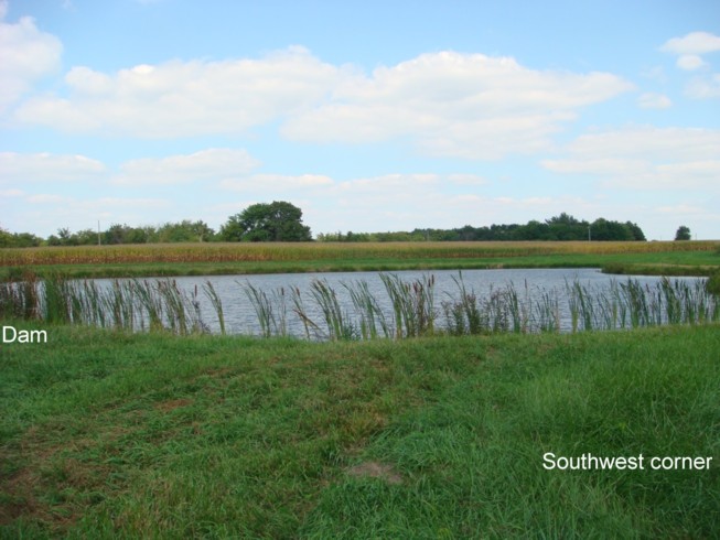

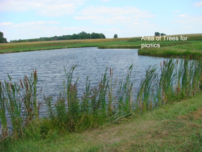
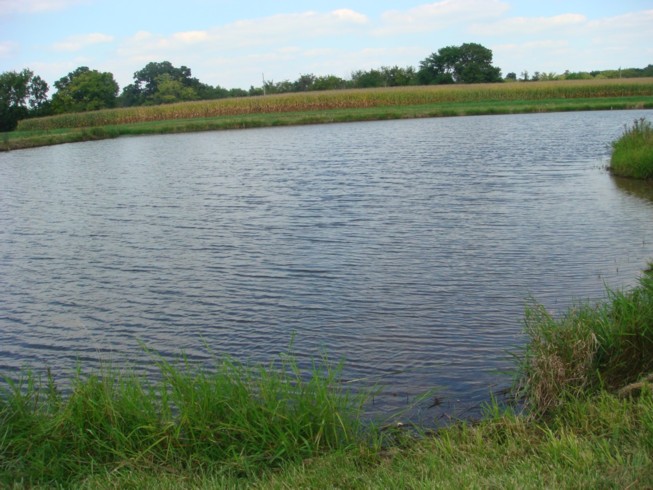
When the area was a park there was a grove of trees on the east side of the pond where you could picnic.; Raymond Dennis drowned August 2, 1914, in the pond in Stead's Park. Later in years, two brothers, last name may have been Turner, drowned in the pond. After the two brothers died, the dam was torn up.; John's father, Roy Boehler, cleaned up the pond and rebuilt the dam in 1954. It is a nice looking pond. Allen Boehler, another son of Roy, said, at one time, there had been a horse race track there. In 2009, John Boehler owned the pond and land around it.; From 1969 History of the Nilwood Baptist Church: "Later, Stead's Park, a pond and picnic grounds, would be developed on property settled by Samuel Stead, three miles east of Nilwood and one-half mile west of McVey. Many are still around who have fond memories of pleasant hours spent at Stead's Park, which at one time was leased by Nilwood.)" Some remember swimming in the pond as late as the 1950's.
Steubenville - Polk Township; Illinois Place Names: STEUBENVILLE (Macoupin) - Also North Bend (Alton Telegraph 4/6/1836; 1879 hist. 213; 1911 hist. 397); More about Steubenville in in Jim Frank's History of Polk Township
Stirrup Grove - North Otter Township; Illinois Place Names: STIRRUP GROVE (Macoupin). PO est. 22 Sep 1858; dis. 29 Nov 1895. Later Chapman's Point.; Unknown source: "Stirrup Grove Post Office was located in the west part of Section 7 of North Otter Township. Then called Pleasant Grove by a few and later named Chapman's Point. Stirrup Grove was still listed as a having a Post Office on the 1893-94 plat map. I don't know much about Stirrup Grove except that it was probably a community of farmers. I don't know of a town as such located in the area. You will see Stirrup Grove Post Office listed in the 1850, 1860, 1870,... Federal Censuses for citizens living in the area."
Stull - IT 1930 Stringham
Sulphur Springs - Nilwood Township; Illinois Place Names: SULPHUR SPRINGS (Macoupin). See 1911 hist. 376.; Girard Gazette, April 14, 1881, pg. 1: "Sulphur Springs is a small village, so called from two springs of sulphur water near by, and is situated one quarter miles west of Rural Park, and one mile east of where Seymour Station ought to be."
Summerville - Chesterfield Township; Lat 391120N Long 0900725W; Illinois Place Names: SUMMERVILLE (Macoupin). See 1911 hist. 403-4. Summerville was established before 1850. It was located on the cross lines of Sections 29, 30, 31, and 32 in Chesterfield Township. There was a school, Baptist Church and Cemetery, and about 40 town lots. By 1893-94, the St Louis, Chicago, and St Paul was built and ran through Summerville. The location is marked on a recent plat map.
Thacker - Nilwood Township; IT stop
Tickey Mound - Bunker Hill Township; Illinois Place Names: TICKEY MOUND Macoupin. See 1879 hist. 143.
Trumbull - Chesterfield Township; Illinois Place Names: TRUMBULL (Macoupin). PO est. (ch. from Rhoades' Point) 16 Feb 1863; ch. to Medora 9 Jul 1866.
Vancil's Point - North Palmyra Township; Illinois Place Names: VANCIL'S POINT (Macoupin) PO est. 22 Sep 1858; dis. 16 Jun 1884.; On the 1875 plat map, Vancils Point Post Office was located in the southwest corner of Section 4 of North Palmyra Township.; Vancils Point was probably named after I. B. Vancil who came or was born in the county in 1828. By 1893-94, I. B. Vancil probably owned over 1000 acres in the area. Just west of the Post Office was School #4 and just west of the school was a Christian Church. There were a couple of houses closeby. It appears to be a community crossroads where possibly there may have been a store with the Post Office. By the 1893-94 plat map, Vancils Point is no longer on the map.
Vaniman - Virden Township; Illinois Place Names: VANIMAN (Macoupin). RFD Virden. IT. (a stop on IT located about a 1.6 miles south of Virden) (possibly in Girard Twp)
Village of Staunton - Staunton Township; The Village of Staunton no longer exists. Staunton and the Village of Staunton apparently existed as separate towns at the same time.
Virden - Virden Township; Lat 393003N Long 0894604W; Illinois Place Names: VIRDEN (Macoupin). PO est. 12/10/1852; active; RFD serves Monroe. Inc-c 2/16/1865. C&NW/CB&Q/GM&O/IT. Pop. (1960) 3,309. Virden's population was 3,899 in 1980 and, in 1990, Virden's population was 3,635.
Wagoner's Prairie - Hilyard Township; Illinois Place Names: WAGONER'S PRAIRIE (Macoupin). See 1879 hist. 213.
Wall - Staunton Township; a train stop on the IT railroad
Waytown - Girard Township; Illinois Place Names: WAYTOWN (Macoupin). Now part of Girard.
Weatherford's Prairie - Brushy Mound Township; settlement; History of Macoupin County, 1879 p 162. "Located in the northeast corner of the township." ... "In 1833-34, Jefferson Weatherford built an ox mill on Weatherford's Prairie, on the line of the Carlinville and Hillsborough road."; Illinois Place Names: WEATHERFORD'S PRAIRIE (Macoupin). See 1911 hist. 372.
Weller - South Otter Township; only an IT train stop; IT 1930 Stringham
White City - Mount Olive Township; From Gerry Clark: White City is located west of Mt Olive on Route 138 just off Interstate 55. White City was incorporated as a village 23 Feb 1859. White City is RFD Carlinville. It is located in Sections 4 and 9 of Mt Olive Township. In 1908, the population of White City was 800. The population of White City has increased to about 310 from a low of about 200 citizens. The coal mine's company houses were moved from the 1904 World's Fair in St Louis to White City for the coal miners. The houses were torn down a number of years ago.; Illinois Place Names: WHITE CITY (Macoupin). RFD Carlinville. Inc-v-6/21/1907. Pop. (1960) 197.
Whitworth - Brushy Mound Township; only an IT train stop; 1930 (Stringham)
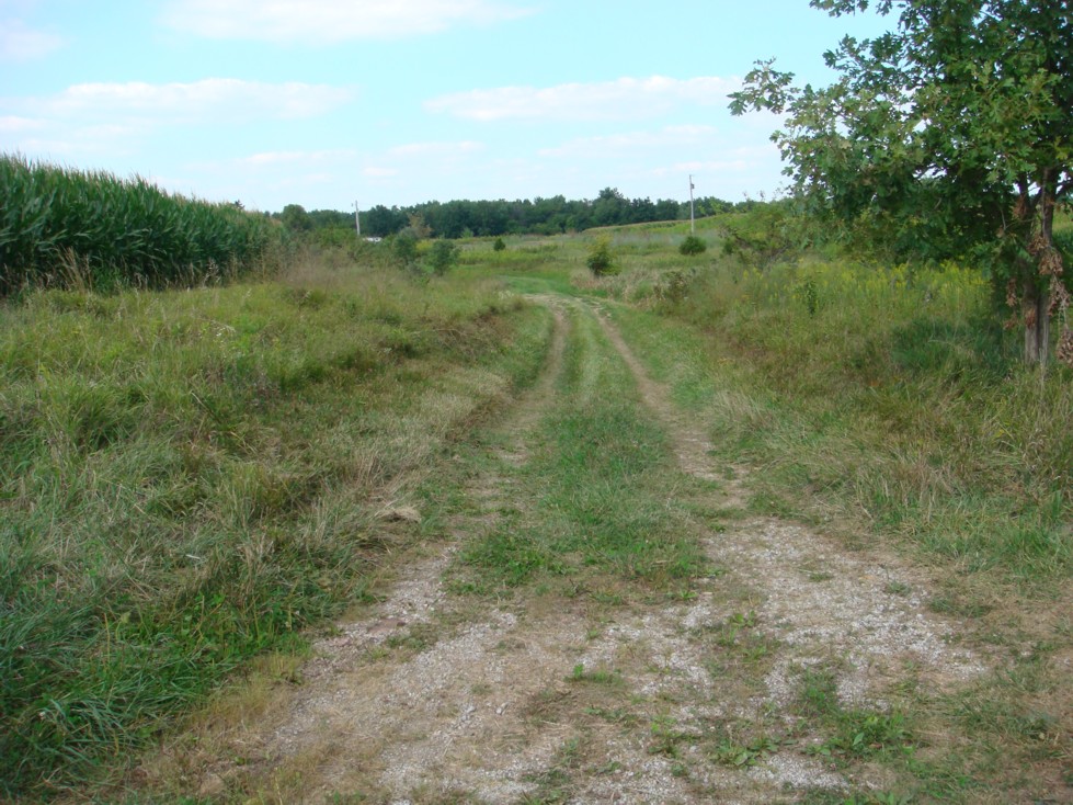
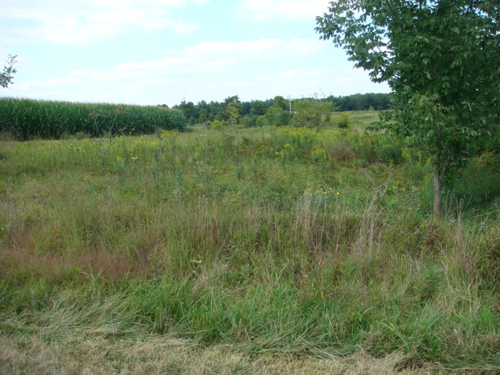
Wild Rural Park - Nilwood Township; not a populated place; 2009 Directions to Wild Rural Park: Using the 911 road names, you would leave east out of Nilwood on the Waggoner Road to Boston Chapel Road. Turn south on Boston Chapel Road and go to the Sulphur Springs Church and Cemetery located on the west side of the road. The written history recalls that Wild Rural Park was east of the church. It is east of the church but further east than just across the road. The park was located north side of Sulphur Springs road and 1/4 mile west of Slightom Road.;
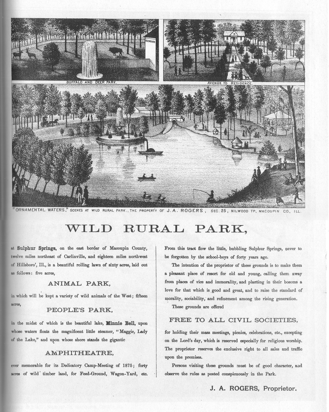
From 1969 History of the Nilwood Baptist Church: "At this time there existed a wonderful recreation park at Sulphur Springs, in the southeast part of Nilwood Township, across the road east of Union Church. It was visited by many of the Nilwood townspeople. Called "Wild Rural Park," it consisted of sixty acres, including an Animal Park, in which were kept a variety of wild animals of the West; a park in which there was a small lake, and on the lake shore, the Amphitheatre. The grounds were made available free to "all civil societies for holding their mass meetings, picnics, celebrations, etc., excepting on the Lord's day, which is reserved especially for religious worship." (Several of today's members recall attending church picnics at Wild Rural Park about 1915 to 1920.)
Wilsonville - Dorchester Township; Lat 390415N Long 0895122W; Wilsonville was incorporated as a village 28 May 1919. The post office at Wilsonville was established 25 Jun 1924. In 1980, the population of Wilsonville was 608 and, in 1990, the population was 609. Wilsonville is located on Route 138 in Sections 3 and 10 of Dorchester Township.; Illinois Place Names: WILSONVILLE (Macoupin). PO est. 25 Jun 1924; active. Inc-v-5/28/1919. Pop. (1960) 688.
Wolf Ridge - Bunker Hill Township; Illinois Place Names: WOLF RIDGE (Macoupin). Now Bunker Hill. (1911 hist. 359).
Womac - Shaws Point Township; Illinois Place Names: WOMAC (Macoupin). PO est. 8 May 1888; dis 15 Oct 1910; now RFD Carlinville. C&NW. Womac is located in Section 32 of Shaws Point Township. Womac was established after 1875 when the Jacksonville Southeastern Railroad went through the area.
Woodburn - Bunker Hill Township; Woodburn is located in Section 17 of Bunker Hill Township.; Illinois Place Names: WOODBURN (Macoupin). PO est 5 May 1837; disb 30 Apr 1907; now RFD Bunker Hill. Pop. (RM58) 180.
Youngs - Brushy Mound Township; only an IT train stop; 1930 (Stringham)
Zanesville - in Montgomery County
Original list extracted from Illinois Place Names, by James N. Adams, 1968. A few additions were from Illinois Terminal, the Electric Years, by Paul H Stringham, 1989. Many of the names can also be found listed and mapped online at USGS GNIS.